
Looking up your Stratford neighbors by block
A block lookup expands from one known address to nearby parcels, then adds dated records and public community context. The sources below are not interchangeable. GIS answers where a parcel sits. Vision answers who owns it. A deed can show a transfer. A directory can show a past listed name. An association notice can show a public meeting route. None is a complete roster of people who live nearby.
| Source | What it shows about a block | Access |
|---|---|---|
| CT Metro GIS | Parcel polygons, frontage, nearby lots, and map geography | Public map viewer and parcel clicks |
| Vision cards | Owner-of-record, mailing destination, PID/MBLU, value and building fields | One parcel at a time through public search |
| SearchIQS maps and deeds | Subdivision, common grantor, legal description, and transfer sequence | Guest/index route or Town Clerk |
| Planning and Zoning | Applicants, owners, representatives, parcels, notices, and public actions | Online by board, year, and month |
| Engineering and Building | Sewer, drainage, road, curb, construction, inspection, and occupancy events | Office, portal, or focused request |
| Voter lookup | A named person's registration clue, not a block roster | SOTS name-and-town workflow |
| Neighborhood associations | Public meeting and civic connection, not member identity | Town announcement or association page |
| Historical sources | Older listed occupants, events, and neighborhood memory | Library, LOC, newspapers, archives |
Use one row per parcel. Keep PID, MBLU, situs, owner-of-record, mailing address, adjacent parcel, source URL, record date, source type, confidence note, and privacy note. That ledger prevents an owner mailing address from being copied into a parcel's physical location.
Build Stratford neighbor records
Start with a verified street address and USPS ZIP, then open the CT Metro Stratford GIS viewer. Search or zoom to the target, click the parcel polygon, and save the PID or MBLU. Click adjacent polygons one at a time. A road, rail line, easement, river, or shore edge can interrupt visual closeness, so do not draw a block from the screen alone.
- Confirm the target street and postal format with USPS.
- Record the target parcel shape, frontage, PID, MBLU, and visible nearby parcels.
- Open each nearby PID or MBLU in Vision and separate situs from owner mailing address.
- Use SearchIQS for a shared subdivision, map, grantor, or legal description.
- Add a planning, permit, directory, newspaper, or civic source only with its date and role.
The process is geographic first. It avoids starting with a surname that might match several people and makes it possible to explain why a parcel was included in the block.
Open each Stratford neighbor's Vision card
Vision Government Solutions Stratford accepts Address, Owner, Acct#, MBLU, PID, and All modes. Use PID or MBLU after the map, then save the owner, co-owner, situs, mailing destination, value, land and building fields, sale date, book and page, instrument, and ownership history when shown. The current database reflects the 2025 Grand List and values as of October 1, 2025.
A block ledger should have one row for each parcel, not one row for each inferred household. One owner can hold several adjacent lots. One parcel can have several units. A mailing address can be outside the block. An owner-of-record is not proof of current occupancy, and a homestead or exemption clue should not be turned into certainty.
Open the Stratford Vision search for the public field set. If a whole-street question grows beyond the immediate block, use the Stratford street directory walkthrough for the full address chain.
Use Stratford neighbor context
SearchIQS maps reach March 17, 1859, and the current land-record index reaches June 19, 1964. A recorded subdivision map can explain why several parcels share a legal origin. A common grantor can show a transfer pattern. A deed can connect a parcel to a legal lot, book, page, instrument, and date. These are block-history facts, not proof that owners know one another.
Search the current owner or entity as grantee, compare the legal description, and follow the grantor backward. If a street number fails, use PID, MBLU, lot, map, book/page, or instrument. The live Stratford SearchIQS guest search was not fully available during research, so confirm the local result at the Town Clerk counter, by phone at 203-385-4020, or through a focused request.
For a map or deed not online, the Town Clerk, Engineering Division, State Library, and Historical Society are the fallback chain. Preserve the original map or certified citation before describing a block's earlier shape.
Add Stratford permit records
Planning and Zoning posts Applications, Notices, Agendas, and Minutes by board or commission, year, and month. Materials are commonly posted at least seven days before a meeting. Packets can identify an applicant, owner, representative, parcel, address, and land-use action. Engineering records can add subdivision, sewer, drainage, road, sidewalk, curb, and map context.
Building Official records cover construction, additions, renovation, demolition, signs, trade work, inspections, and certificates of occupancy. ViewPoint Cloud supplies an online application and payment route, but the public completed-record search by owner or address was not confirmed. Ask the office for a date-bounded index or use the Stratford FOI route when a non-exempt file is not posted.
A permit applicant or contractor is not necessarily the current owner or a neighbor. Label the role and date. This keeps a block history useful for understanding a road, building, subdivision, or civic concern without inventing a personal connection.
The Stratford ViewPoint route is the official portal link for permit applications. The capture below shows the route, not a confirmed completed-record search.
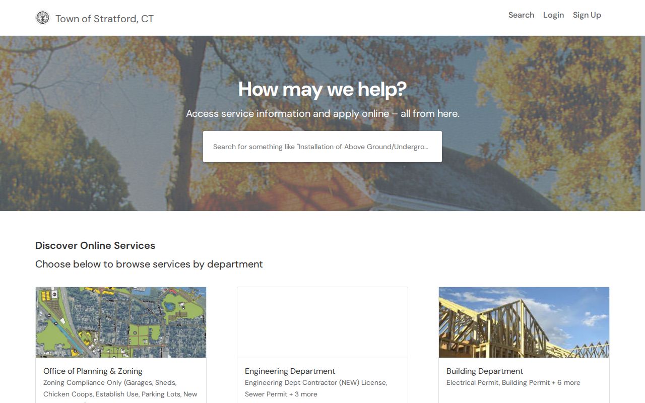
Use the ViewPoint image as a prompt to check the department, permit type, and date, then verify any people or parcels with the custodian's record.
Read older Stratford neighbors in directories
Stratford Library holds city directories, reverse or criss-cross material when available, telephone books, newspapers, clipping files, yearbooks, and town reports. The Library of Congress Bridgeport division includes Stratford. Search the street and year, copy the printed name and page, and keep subscriber or household language exactly as printed.
A telephone listing can show a subscriber without showing everyone at an address. A directory can list a business, boarder, or non-owner household member. If the library lacks the year, try the LOC digital collection, State Library, Historical Society, census, newspapers, or the Town Historian. The absence of a volume is not evidence that no one lived on the block.
For a historical block, add the publication, year, page, street spelling, division, and image link to the ledger. A dated page is a historical clue. It should not be mixed with a current Vision owner row.
Use Stratford voter records
Connecticut's public voter lookup begins with town, last name, first name, and date of birth. It is not a free street browse. The public date-of-birth output now gives only the year under PA 26-1 §96, and protected voters or Address Confidentiality Program participants may be withheld or represented by a substitute address.
The statewide voter file costs $300, arrives as CSV, and the voter-file request form restricts use to election-related, scholarly, journalistic, political, or governmental purposes. It also bars household harassment, advertising, marketing, and reproduction or display. A block research note should never suggest that a public street roster can be downloaded for private use.
For local status or correction, call Stratford's Registrars of Voters at 203-385-4049. For a named person, compare the voter result with Vision, a deed, a court, or a dated directory. Registration is a record relationship, not proof that every resident at the address is present.
Meet Stratford neighbor groups
The Town announced informal neighborhood associations for each of Stratford's ten districts beginning in February 2026. The announcement says community members are welcome at meetings without invitation, where local concerns, development plans, and solutions can be discussed and residents can connect with the Mayor's Office and Town Council. It does not publish a member roster or block addresses.
Ten district associations
Informal civic groups
Open community meetings
Town announcement route
Lordship Improvement Association
Coastal peninsula civic group
All-volunteer nonprofit
Public meetings and land trust
Association pages provide a community contact route, not a list of who lives on a block. Meeting notices can be paired with a Planning and Zoning agenda or map, while names of applicants and officials stay tied to the public filing that names them.
Follow Stratford neighborhood records
Lordship is a coastal peninsula identity inside Stratford's geographic story. The Lordship Improvement Association describes an all-volunteer nonprofit, a land trust, public meetings, and a mission dating to 1924. That history can explain why a street or parcel appears in a civic notice, coastal land-use discussion, or neighborhood archive.
Use the association's public information with Town meeting records, Planning and Zoning documents, maps, and local newspapers. Keep the result labeled as community context. A meeting notice shows that a public event or issue exists; it does not prove attendance or residence for a named person.
The coastal setting also makes map work important. Water, roads, and peninsula access can affect which parcels sit next to one another. CT Metro and the parcel legal description are better guides than a casual radius drawn from a street name.
Respect Stratford neighbor privacy
A block record can show parcel geometry, owner-of-record, mailing destination, a recorded document, a permit event, a historical listing, or a public civic meeting. It cannot show every non-owner household member, child, visitor, delivery recipient, private utility customer, unregistered person, or protected voter. Connecticut FOI can open a non-exempt public record, but it does not override a specific confidentiality law. The Attorney General's Connecticut Data Privacy Act page describes separate rights and exemptions for personal-data processing.
Use three evidence labels: parcel fact for a Vision or GIS field, historical clue for a dated deed, directory, newspaper, permit, probate, or image, and community context for a public meeting, association notice, museum story, or planning event. Never combine the labels into a claim that adjacent people are connected.
Lawful personal use. Stratford neighbors research is appropriate for a property question, family history, civic meeting, or block history. Do not use a neighbor lookup to stalk, harass, intimidate, or harm anyone. Ask for redaction when a record reaches protected information.
When a source does not support the name or relationship being sought, stop at the parcel or public event. A careful “not shown” is more accurate than a block roster assembled from inference.
Use Stratford neighbor records
A shared subdivision map can show common development. Adjacent parcels can show geography. A newspaper can show a dated event. A neighborhood association can offer a public meeting route. None of those facts proves that two owners know one another or that a named person attended a meeting.
For repeat work, keep a small ledger with parcel PID/MBLU, situs, owner-of-record, mailing address, adjacent parcel, source URL, record date, source type, confidence note, and redaction note. Save a map or legal description before adding a person name, especially for condos, rear lots, industrial parcels, and water frontage.
The full named-street chain belongs on the Stratford street directory page. The block method here ends at a defensible set of parcel facts, dated clues, and public community context.