
Stratford ZIP Code Directory: verified set
The official USPS Postal Bulletin material inspected for Stratford identifies 06614 and 06615. It does not verify another Stratford ZIP, a PO-box-only code, a unique institutional code, a ZIP realignment year, or a current ZIP population. The safest ZIP code directory therefore lists the two verified codes and sends every exact address to USPS By Address.
| ZIP | Areas or examples covered | Post office / delivery label | Notes |
|---|---|---|---|
| 06614 | Paradise Green; Police at 900 Longbrook Avenue; other addresses require exact checking | USPS Stratford, CT delivery area | Neighborhood names are not a full ZIP crosswalk. |
| 06615 | Town Hall, 2725 Main Street; other addresses require exact checking | USPS Stratford, CT delivery area | Use the street address, not a broad town assumption. |
The “areas” column uses verified civic examples, not a claim that every address in a named neighborhood shares one ZIP. USPS should answer the final delivery question. The Town's civic addresses make the split visible, but only the postal result can validate an exact mailing format.
Stratford ZIP records: 06614
Paradise Green's official Town page at Main Street and Huntington Road uses Stratford, CT 06614. The Police Department at 900 Longbrook Avenue also uses 06614. Those examples support 06614 in Stratford's postal geography, but they do not draw a line around all of Paradise Green, South End, Lordship, or another named place.
A ZIP code is a delivery route. It can serve a civic address, a neighborhood, or a street segment without matching a town boundary. An owner may also receive tax mail at a different ZIP. If the question is who owns a parcel, use the situs address in Vision and keep the owner's mailing address in a separate field.
The USPS city and ZIP reference and Postal Bulletin ZIP listing are the sources for the verified 06614 and 06615 context. Pair them with the address tool instead of turning a postal code into a resident count.
The USPS city-and-ZIP reference route is a geography check. It belongs before a street or parcel search, not in place of one.
Stratford ZIP records: 06615
Stratford Town Hall at 2725 Main Street, Room 106, uses Stratford, CT 06615. That civic address gives the postal directory a firm local example. It does not establish a boundary for every Main Street number, and it does not mean an owner’s tax-mailing address has the same ZIP as the parcel.
When a form asks for a ZIP, copy the USPS result exactly, including the city and state label. When a deed or assessor card asks for a parcel, use PID, MBLU, map, block, lot, unit, book, page, or legal description as the stronger key. Postal and property systems overlap at the street address but answer different questions.
For a civic record, the Stratford Town Clerk page supplies the office route. For a delivery record, USPS remains the final check. Keeping those roles separate prevents a postal directory from becoming a false map of residents.
Use Stratford ZIP lookup
USPS ZIP Code Lookup offers three modes. By Address asks for street address, city, and state, with optional company and apartment or suite fields. By City and State checks a place pair. Cities by ZIP accepts a five-digit ZIP. The output verifies delivery information. USPS warns that it does not confirm a person or business is present at an address.
Run the full street address first. If a road name or unit does not match, try the exact USPS spelling, then ask the town office about a parcel or address crosswalk. Do not use a guessed ZIP in a deed, voter, or court search when the postal result is available.
Open USPS ZIP Code Lookup for the live field set and result. Postal data changes, so a static capture is a reference rather than a permanent answer.
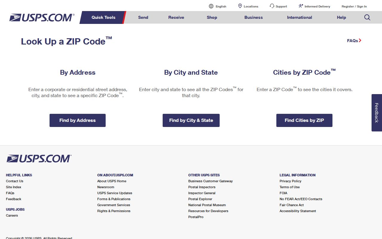
The capture shows the address, city, state, and cities-by-ZIP modes. It confirms mailability, not occupancy.
Keep Stratford ZIP records separate
Stratford's coastal and river setting includes Lordship, Paradise Green, Stratford Downtown, Mill Plain, South End, and other geographic labels. Census reference maps can label those places, but they are not ZIP boundary maps. A ZIP may cross a neighborhood label, while a town line may not follow a postal route.
Use five separate labels in a research note:
- Situs
- The parcel's physical location in Vision or GIS.
- Mailing address
- The owner's tax correspondence destination, which may be elsewhere.
- Legal description
- The deed or map language that identifies a lot or unit.
- Postal address
- The USPS delivery format and ZIP.
- Parcel identifier
- PID, MBLU, or account number that links property records.
This distinction is the core of a useful postal directory. A postal code can narrow a delivery search, but the parcel ID or street remains the fine-grained key for ownership and history.
Which Stratford portals accept a ZIP code
Very few local systems use ZIP as their primary search key. A ZIP field can narrow a route without turning it into a resident list. Compare the portal's result meaning before relying on it.
| Portal | ZIP field | What the result means |
|---|---|---|
| USPS Lookup | Yes | Delivery format and ZIP verification. |
| Vision Stratford | No visible ZIP filter | Search by address, owner, account, MBLU, PID, or All. |
| Civil property-address inquiry | Optional five digits | Narrow court-address results by town, property type, status, and ZIP. |
| SOTS voter lookup | No visible ZIP field | Town, name, and DOB workflow with protected output. |
| SearchIQS | No visible ZIP field | Party, date, document, book/page, instrument, or case search. |
| CT Metro GIS | Not verified | Map and parcel geography; ZIP layer or search not confirmed. |
The civil address form is a narrow case route, not a property or occupant database. The sex-offender registry can use ZIP or radius modes under its own rules, but it is a last-known-location registry, not a general postal directory.
Use Stratford ZIP geography
CT Metro GIS can move from a street segment to a parcel polygon and PID. The Census TIGER county-subdivision table can show Stratford's town geography and named places. Neither source was verified as a current ZIP boundary map. Use them to understand the shape of a place, then use USPS for delivery geography.
The Census 2020 county-subdivision table reports Stratford town population at 52,355. A QuickFacts table used in research gives a 2025 estimate of 53,908, but no verified 06614-versus-06615 population, voter count, or resident count was found. Do not split town population between ZIP codes without a source.
A map is especially useful near water, a river, a town line, a long road, or a parcel with more than one frontage. Click the polygon, save PID or MBLU, and return to the Stratford street directory for the address-record chain.
Read Stratford ZIP court records
Connecticut's civil property-address search accepts a city or town, optional partial street address, optional five-digit ZIP, property type, and case status. The research notes foreclosure cases from January 1, 2014 and another narrow case category from March 1, 2016, with some records removed after disposition or final activity. These dates describe the court inquiry, not the age of a parcel or the people connected to it.
The state sex-offender registry can support ZIP and radius searches under registry law. Its results and warnings concern last-known registry location and offense information. DESPP says it has not assessed current dangerousness. Keep that disclaimer with any result and never turn it into a complete list for a ZIP.
ZIP filtering can be useful for finding a court-address lead or checking a registered location, but a person match still needs a second identifier and a lawful reason. A postal code alone is not identity evidence.
No verified Stratford ZIP realignment is posted
The inspected official sources do not identify a Stratford ZIP split or realignment year. They also do not verify a PO-box-only Stratford ZIP, a unique institutional code, or a full ZIP-to-street crosswalk. That is a meaningful research result. It means the postal directory should not fill the gap with a guessed neighborhood boundary.
If a historical address appears to use another code, compare the printed directory page, USPS delivery result, Town Clerk map, Vision parcel, MBLU, legal description, and nearby parcels. Ask Planning, Engineering, the Assessor, or the Town Clerk whether an address ordinance or map crosswalk exists. An FOI request can ask for a non-exempt address crosswalk or ZIP-specific parcel export, not protected resident details.
For records from before a modern postal format, an old directory or map may be more useful than the ZIP. Preserve the source year and page; the postal code may not have been printed or may reflect a later delivery convention.
Bring Stratford ZIP records to parcels
A reliable ZIP code directory workflow ends at the parcel or record key. After USPS confirms 06614 or 06615, search Vision by address, owner, PID, or MBLU. Use CT Metro to compare parcel shapes. Use SearchIQS for the recorded-document trail. Use Planning, Building, or Engineering for a dated land-use event. Use the library for an older address or person.
- Confirm the full postal address and ZIP with USPS.
- Save the situs, PID, MBLU, and owner mailing destination separately.
- Check whether the question concerns a parcel, a court case, a historical subscriber, or a person.
- Use the custodian's access route and record the source date, role, and coverage gap.
ZIP narrows geography. It does not prove a resident, owner, voter, or business relationship. Keeping that limit visible is what makes the Stratford ZIP code directory useful for address research without overstating what a postal result can say.